


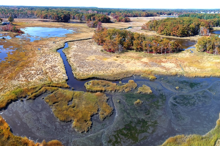
New England’s salt marshes are changing, and so are the technologies used to monitor their transformations. UNH researchers are now relying on cutting-edge unoccupied aerial vehicles (UAVs, more commonly called drones) that capture aerial images to monitor shifts in marsh vegetation species, indicating changes in the health and longevity of these critical ecosystems.
In a study published in the journal Remote Sensing, researchers relied on UAV-derived images of the marshes that used near-infrared color wavelengths combined with elevation data to map various vegetation species within these landscapes. This approach outperformed true-color images even when they were paired with elevation data. The study further demonstrated that the best time of year to capture UAV images for mapping marsh species in our area was early October.
“Marshes are at risk because of many drivers, including urban expansion and sea-level rise,” explains Michael Routhier, researcher in the UNH Earth Systems Research Center and the first author on this study. “The use of UAV remote sensing techniques provides a novel way to monitor these ecosystems at very high spatial resolutions not available from conventional aerial or satellite remote sensing techniques.”
Salt marshes are critical habitats. They provide homes and nurseries for numerous flora and fauna, buffer the effects of wave action and storm surge to our coastlines, trap sediments to help keep our coastal waters clean, and act as a sink to the larger global carbon cycle, Routhier notes. The methods and findings of this research can provide resource managers with insights into how best to monitor marshes over time to help maintain their survival.
The?UNH Institute for the Study of Earth, Oceans, and Space (EOS)?is UNH's largest research enterprise, comprising six centers with a focus on interdisciplinary, high-impact research on Earth and climate systems, space science, the marine environment, seafloor mapping and environmental acoustics. With approximately 100 principal investigators managing more than 400 individual grant awards, and with annual expenditures exceeding $95?million, EOS fosters an intellectual and scientific environment that advances visionary scholarship and leadership in world-class and graduate education.??
-
Written By:
Rebecca Irelan | Institute for the Study of Earth, Oceans, and Space | rebecca.irelan@unh.edu | 603-862-0990


